-
25,14
USD
-
* Free shipping to US.
-
-
Not available
Features:
- Pages: 220
- Format: 0,8x16,6x23,60 cm
- Edition: 2007
- Language: Castellano.
- Binding: Libro.
- Weight: 0,24 kg.
- Editorial: BIB. NAL. (ESPAÑA)
-
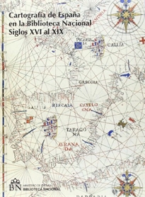
Cartografía de España en la Biblioteca Nacional (Siglos XVI al XIX). Tomo I, II y Adenda
-
9788488699985
-
-
-
-
-
-
La Biblioteca Nacional de España conserva una relevante colección de fondos cartográficos antiguos y modernos en su mayoría de España, y una gran colección de atlas y obras especializadas en cartografía, geografía y astronomía. En esta adenda se describen mapas de los siglos XVI al XIX adquiridos durante los últimos años, piezas de gran valor que han pasado a formar parte de los fondos de la Biblioteca Nacional.
-
25,14
USD
-
* Free shipping to US.
-
-
Not available
The book belongs to the following catalogs
Other books in the subject Mapas Geográficos (Especializados):
-
26,89
USD
-
17,28
USD
-
24,39
USD
-
24,36
USD
-
65,78
USD
-
25,02
USD